A high-resolution satellite map of the entire world is now available to all free and paying users of MapTiler Cloud. The stunning map layer from Maxar is a seamless bridge between our in-house mid-resolution map and very high-resolution aerial imagery that predominantly covers the world’s economic hubs.
Key features
- Resolution: globally 1-2m/px, locally up to 8cm/px
- Up-to-date: recent satellite imagery from 2021/2022
- Enjoy seamless zooming from beautiful country-scale imagery to detailed streets
- Use the MapTiler SDK to make sure you always have the latest imagery
- Unlimited browsing for a fixed price thanks to session-based billing
- Download available for off-line self-hosting
Perfecting the satellite map thanks to Maxar
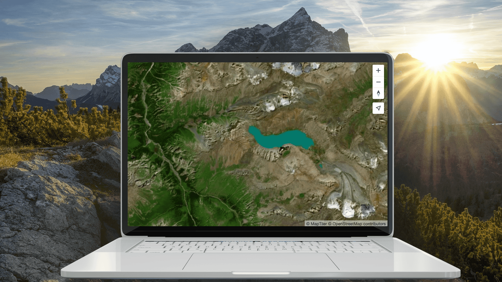
To bring you top-quality maps, we integrated data from the leader in satellite imagery capturing, Maxar. Thanks to this, we have a satellite layer with global coverage that perfectly fills the gap between our mid-res satellite map and high-res aerial map. Integrate it into your web apps using our Standard and Hybrid maps now!
Preview, zoom, and pan by clicking above - on selected areas such as London, Dubai, Toronto, Singapore, Stockholm, and many more!
High resolution everywhere
While aerial imagery can achieve impressive resolutions of up to 8cm/px, it may only be available in some regions. This is why we added Maxar imagery, with a global 1m/px resolution in the most requested areas and 2m/px in the rest of the world.
For more information about your country or area’s resolution and age, see the table on our satellite page.
Browse the map and check the resolution
Always up-to-date
Integrating Maxar’s satellite imagery from the last year enables users to pinpoint recent changes with data no older than two years for the entire globe. We continually strive to provide the most recent satellite and aerial imagery available; approximately half of our areas receive updates every year. This 2021/2022 batch brings fresh Maxar data to the entire planet.
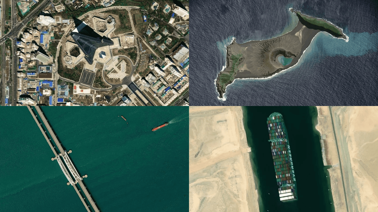
Recent events captured on our satellite map
Satellite Maps combined with our powerful SDK
The MapTiler SDK automatically integrates the most up-to-date version of our satellite map. This means you don’t have to check our website and update your source code constantly to ensure you always have the freshest satellite map in your web apps.
Affordable Maps API for your web and mobile apps
No matter how much your users zoom and pan, we only count each visit as a session in MapTiler SDK. Therefore, the price is charged based only on the number of your website visitors, not on how much they interact with the map. This ensures transparent and predictable pricing and gives you the freedom to design fullscreen interactive apps.
Our work on the satellite map is a continuous journey. We are actively working on adding more countries and updating some of the existing ones. Stay tuned!
Download and self-host for air-gapped environments
A bird’s eye view is often essential for secure, on-premises applications and services operating within intranets or without an internet connection. Various international organizations, state agencies (such as police, ambulance, defense, and firefighters), and companies handling sensitive data find it often necessary to procure satellite imagery of a specific country or region for local server hosting. For these cases, we developed MapTiler Server, which can efficiently serve satellite mosaics on any laptop.
The affordable price tag that we put on our satellite data guarantees accessibility across various use cases.